Collecting Geotechnical and Hydrology data
Predictive
maintenance
Ground and
Aerial mapping
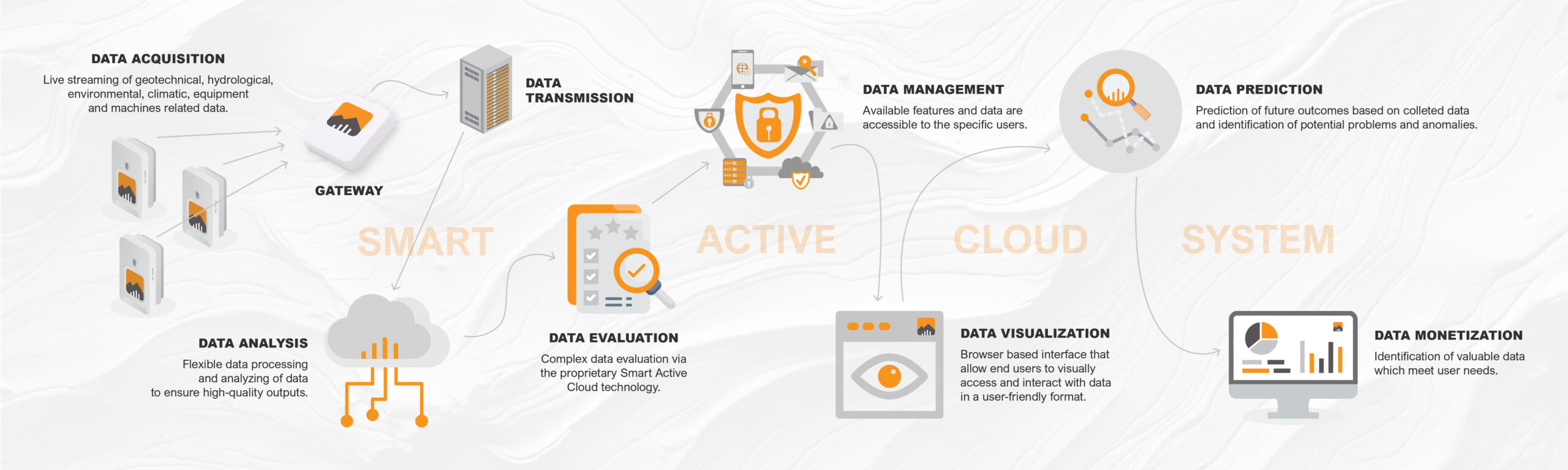
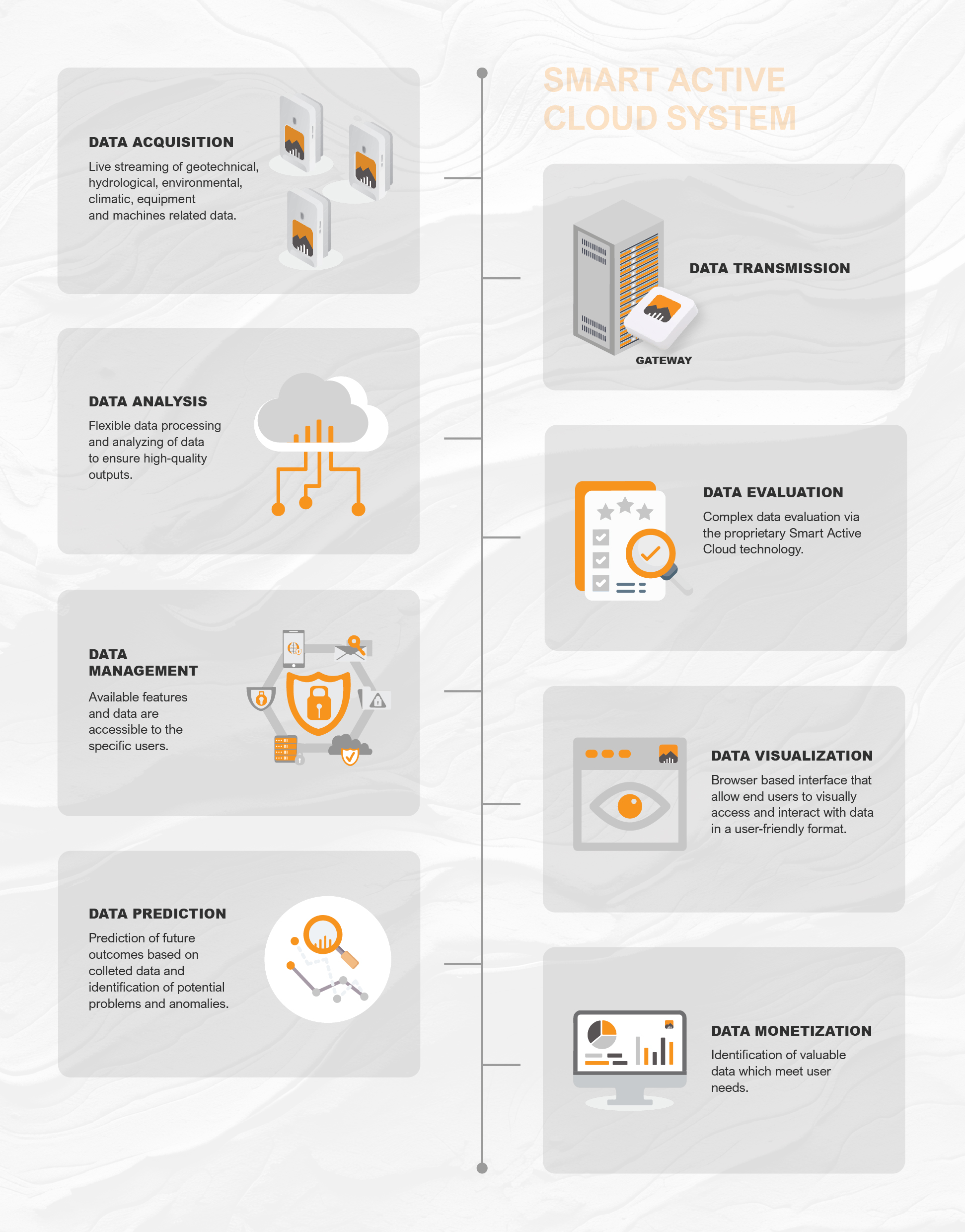
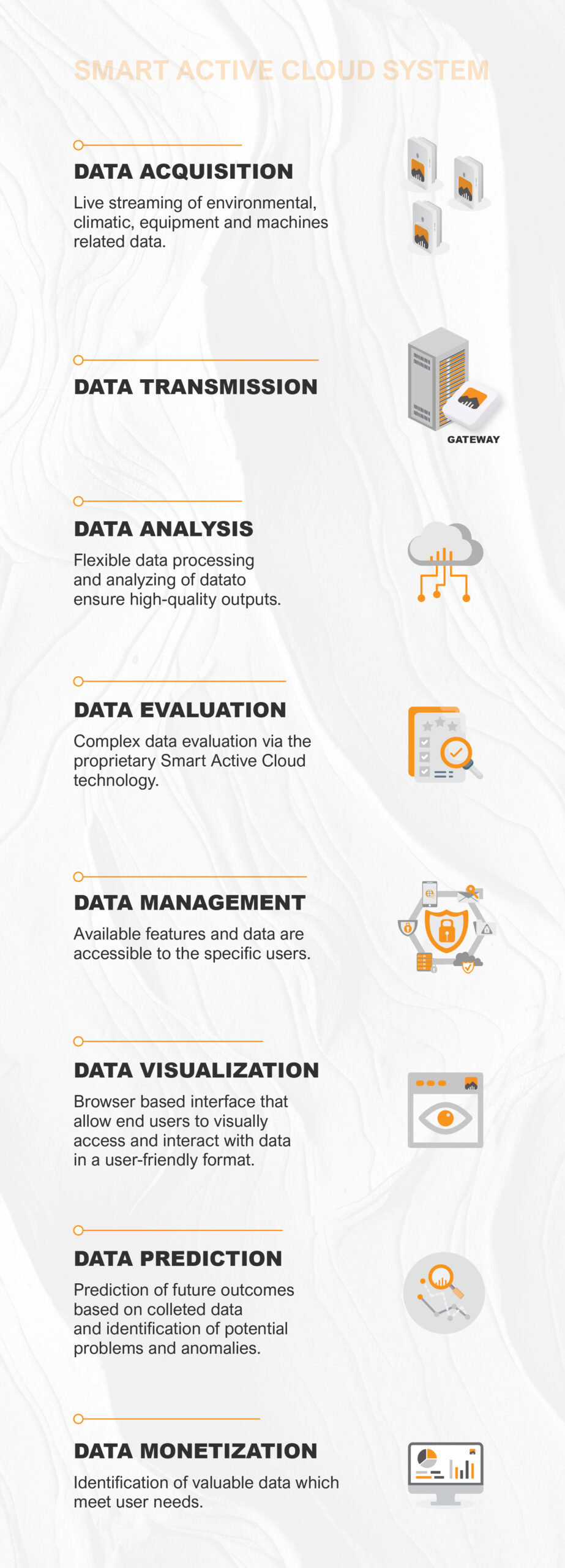
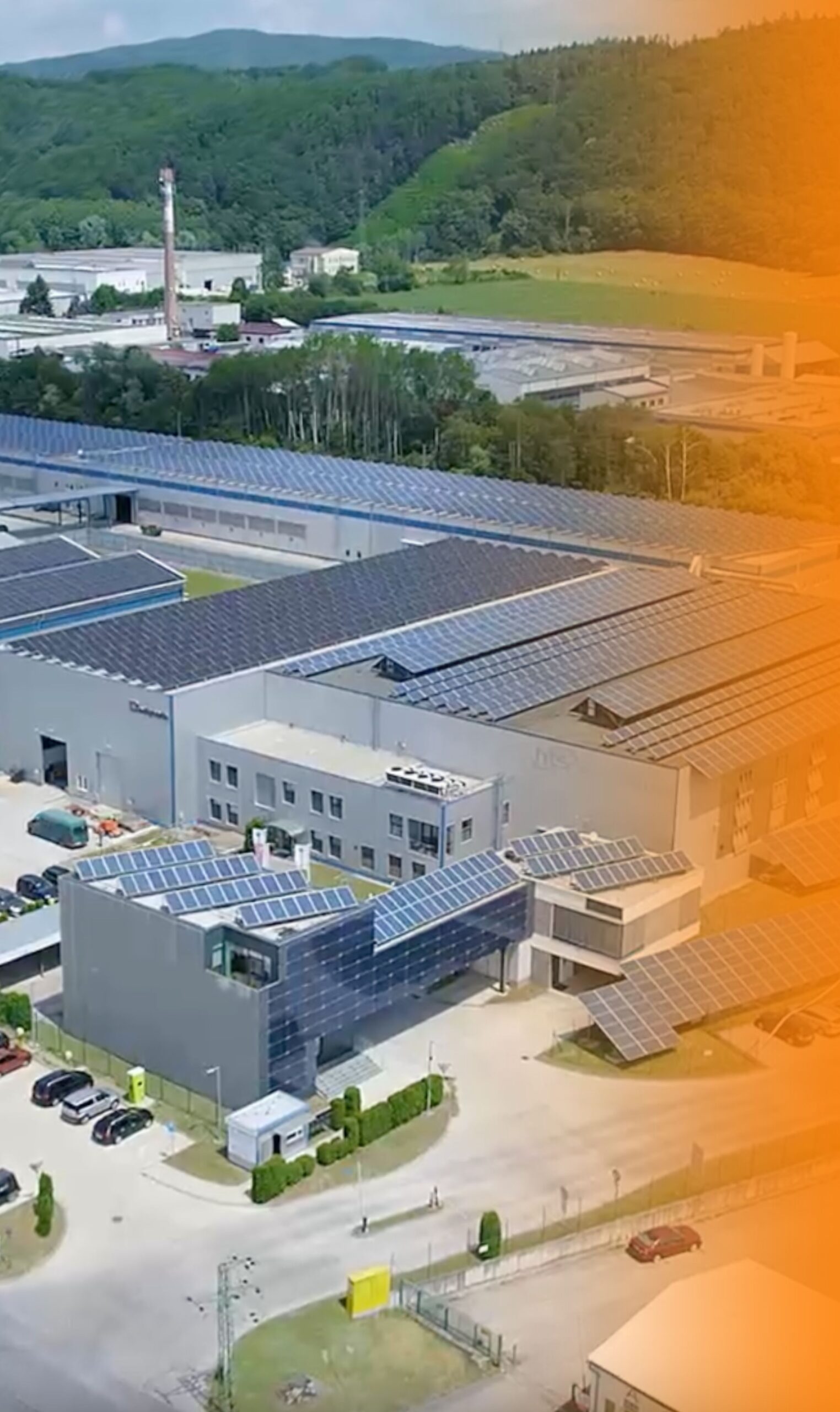
Robust Web-Based Cloud System
Integration and Customisation
Preventive
measures
Personnel
safety
Precise
Calibration
Performance and Responsiveness
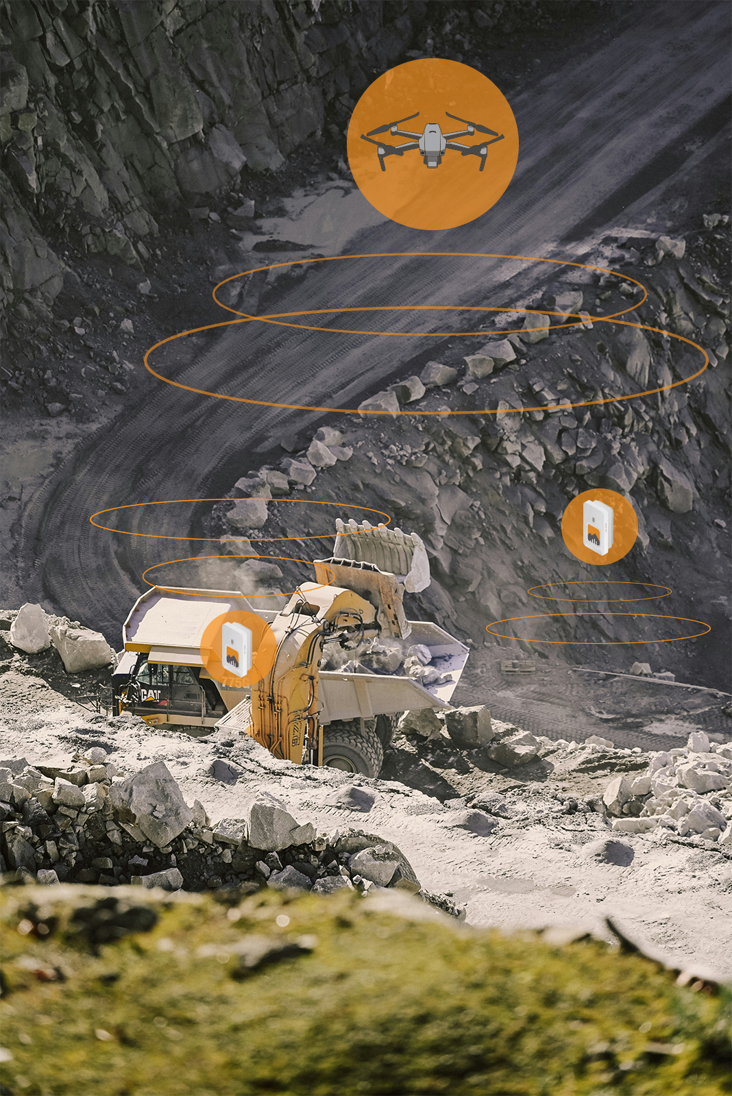
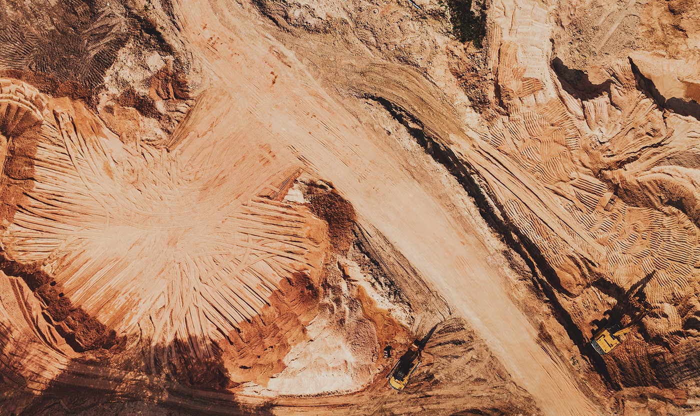
Aerial Monitoring
Drones provide live data feeds, allowing for quick adjustments to plans and improving flexibility. By delivering accurate mapping and modeling, drones help miners optimize resource extraction, reduce waste, and boost overall efficiency.
2D mapping
Our 2D mapping solutions provide a crucial flat-plane representation of underground layouts, tunnels, mineral deposits and landscape and slope stability monitoring. This enables miners, engineers, and planners to clearly understand spatial relationships and make informed decisions for efficient mining operations.
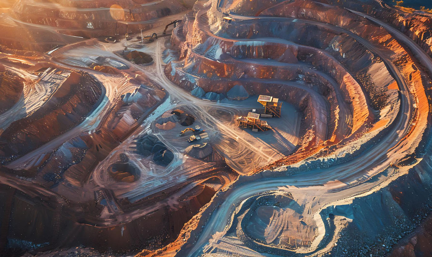
3D mapping
3D mapping involves creating a detailed three-dimensional representation of the underground environment, allowing for better visualization, planning, and decision-making. Compared to traditional 2D mapping, 3D mapping offers greater accuracy and a more comprehensive view of the complex underground structures.
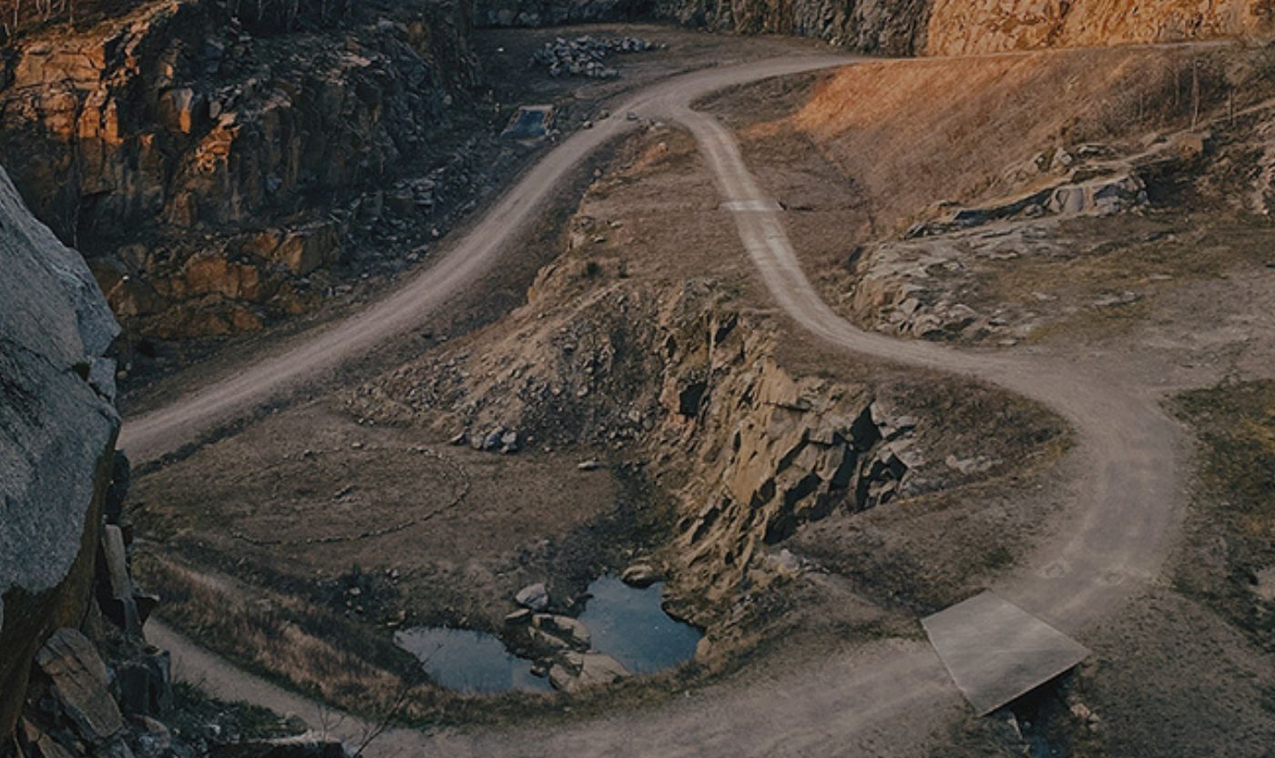
Aerial Monitoring
Drones provide live data feeds, allowing for quick adjustments to plans and improving flexibility. By delivering accurate mapping and modeling, drones help miners optimize resource extraction, reduce waste, and boost overall efficiency.
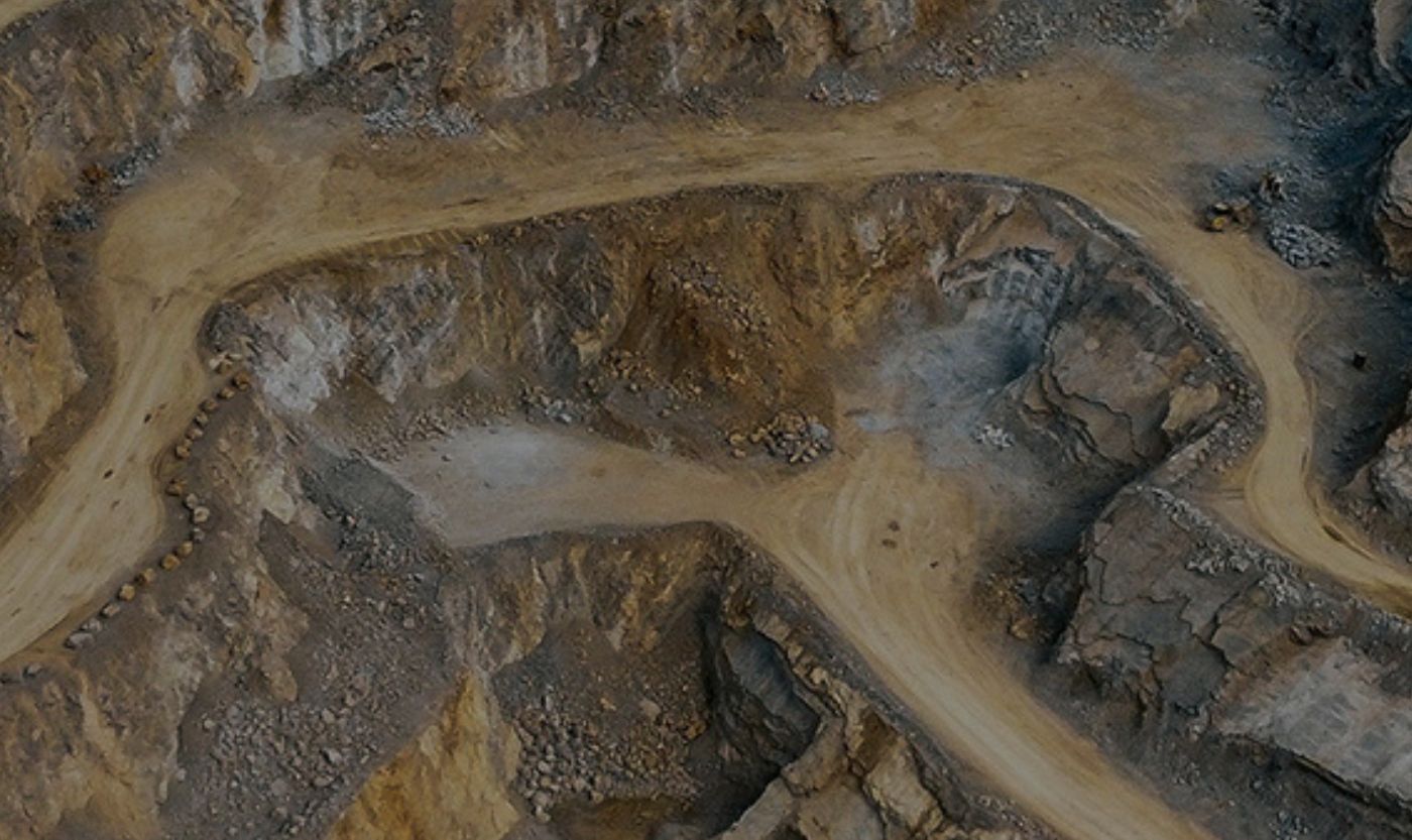
2D mapping
Our 2D mapping solutions provide a crucial flat-plane representation of underground layouts, tunnels, mineral deposits and landscape and slope stability monitoring. This enables miners, engineers, and planners to clearly understand spatial relationships and make informed decisions for efficient mining operations.
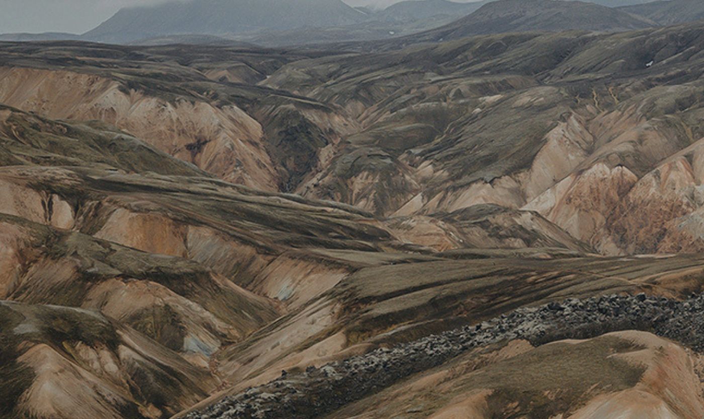
3D mapping
3D mapping involves creating a detailed three-dimensional representation of the underground environment, allowing for better visualization, planning, and decision-making. Compared to traditional 2D mapping, 3D mapping offers greater accuracy and a more comprehensive view of the complex underground structures.
LiDAR
LiDAR technology revolutionizes mining by providing high-resolution, real-time 3D scans. It enables precise resource identification, optimized planning, and risk mitigation by detecting geological hazards early, enhancing safety and reducing costly delays.
Photogrammetry
Photogrammetry is the smart, scalable solution that transforms mines into digital assets through high-resolution 3D models. By converting simple photos into accurate spatial data, it enhances planning, boosts safety, and provides precise measurements for both surface and underground applications—without the need for expensive equipment.